Natural Resources / Energy
Mining & Forestry Applications
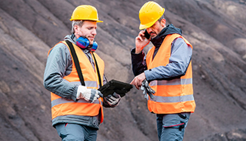
Mining Safety Inspections
A collapsed mining shaft or an injury on the job site can bring your entire production to a halt. Luckily, mining safety technology has continued to evolve, and our Getindo rugged devices thrive in high pressure and high-risk environments. Inspections completed with detection systems driven by Getindo solutions robust Intel® Core™ vPro™ processors can improve mine performance and flag potential issues. Moreover, Getindo rugged solutions can be combined with other solutions to resolve industry-specific challenges making our solutions ideal for the mining industry.

IoT Solutions in Mining Safety: Real-time Geotechnical Risk Management
Dynamic decision making to improve mine safety has been made easier with Getindo solutions. Our fast and powerful WiFi and Bluetooth send real-time inspection data, including predictive analysis, immediately to management. This allows for potentially dangerous areas to be swiftly cordoned off and reinforced to prevent cave-ins and protect your workers. The powerful processing speed of our rugged devices has the revolutionary ability to turn radar data into 2D imaging quickly, which enables informed decisions to be made immediately to improve mine safety.

Mining safety equipment built to handle the unexpected
Getindo is proud to offer solutions that cover a full range of ATEX, IECEx, ANSI, Zone 1 – Zone 2 certifications, able to work in hazardous areas. Our devices run on the Windows 10 operating system, conveniently ready to address both functional and operational challenges that may arise. Certified up to MIL-STD-810H and IP67, Getindo solutions are safe to use in volatile and dusty environments, are vibration and drop resistant, and can operate in extreme temperatures ranging from -29°C to 63°C. Rated up to 95% RH non-condensing, our solutions are rugged enough to withstand an intense day.

Compact and powerful mining safety technology
Carrying heavy gear in the elevator shaft as you head down into the mine or while working kilometres beneath the earth’s surface isn’t ideal. Still, the equipment to keep you operational doesn’t need to be heavy. Getindo solutions are thin and light while remaining rugged enough for a day in the mine.
Our configurable devices will improve the safety of your crew. Whether that is the F110, which is about the size of a piece of paper with an 11.6” screen, or a ZX70 which can easily be held in one hand with its arc case and 7” IPS display. Additional accessories, including harnesses, straps, and handles make it easy to carry our devices with you on the job.

Mining safety rules and regulations always accessible
Inspecting mine shafts is critical to ensuring the safety of your workers and the uninterrupted production of the mine, leaving no time to stop and charge a device. Mining safety documents and the code of mining regulations will always be at your fingertips with Getindo solutions dual hot-swappable batteries, which allow you to start your shift with extended battery life. If one battery starts to run low, replace it with another without ever shutting down or logging off.
VIEW THE NATURAL RESOURCE / ENERGY BROCHURE
GIS Applications in Mining and Natural Resources
For nearly a decade, Getindo has been the solution used by mining companies around the world. Relied on by geological engineers to upload or download real-time measurements of drill hole deviation, spatial data, rock formation variations, or to access their GIS mapping equipment, Getindo solutions keep your mines running smoothly and efficiently.

Keeping GIS for mining and geology connected
When working in the field, connectivity can sometimes be difficult to obtain or interrupted due to remote locations or the high amount of metal infrastructure. Getindo has solved the problem by working with Absolute Software, a leader in next generation Endpoint Resilience™ solutions. Absolute® Secure Access™ is designed to significantly improve the network performance, optimizing connectivity and securing field workers in a way that radically improves the user experience, wherever your work takes you. Paired with Getindo solutions vehicle docks with tri-passthrough capabilities and external antennae, powerful and fast WiFi, Bluetooth, and 4G LTE WWAN, workers will always have access to GIS for mining and geology.
Remaining connected enables front-line miners to send more exact and accurate topographic data to supervisors, improving efficiency. Combining real-time GIS data gathered from the field with proprietary data from the cloud provides for the most precise natural resource management.
Clear display for GIS mapping equipment
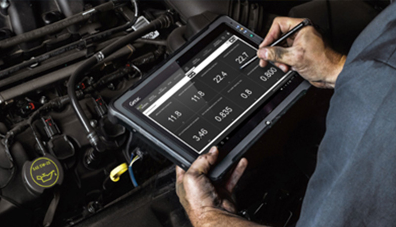
A clear, crisp display is essential for GIS survey equipment and field mapping. Getindo solutions have bright screens, up to 1000 NITS, which can easily be read in direct sunlight or the darkest corner of a mine. Our F110 and F110-EX offer a large 11.6” touchscreen for easy use, and the revolutionary LumiBond® 2.0 display capacitive touchscreen allows for quick access to information and can be used with a pen, stylus, finger, or while wearing gloves – even in the rain. An optional digitiser mode captures handwriting, which can be helpful when making notations of mineral deposits on maps.

Built rugged to improve GIS survey equipment productivity and efficiency
The days of dripping water ruining your paper records are over. Now, mineral exploration requires more efficient methods for sampling, analysis, and mapping than ever before. Getindo solutions are rugged enough to handle a tough day but powerful enough to run the modelling and assessment software solutions needed to enhance exploration productivity and mine capacity. Certified with ATEX and IECEx for use in potentially explosive atmospheres, our devices are redefining what rugged means. Independently tested and certified up to MIL-STD-810H, IP67, and MIL-STD-461G, our solutions are vibration, moisture, dust, and drop resistant. The amazing CPU performance enabled by state-of-the-art Intel® Core™ vPro™ processors makes field mapping and GIS data collection a breeze.

Using GPS for GIS data collection
GIS and GPS go hand in hand, and when it comes to spatial data and mineral exploration, you can’t have one without the other. Getindo solutions offer a dedicated GPS with fast location positioning, improved accuracy and search capacity. For those occasions when the connection is unreliable, the dedicated GPS works even without connectivity.
VIEW THE NATURAL RESOURCE / ENERGY BROCHURE
GIS Mapping and Forest Management
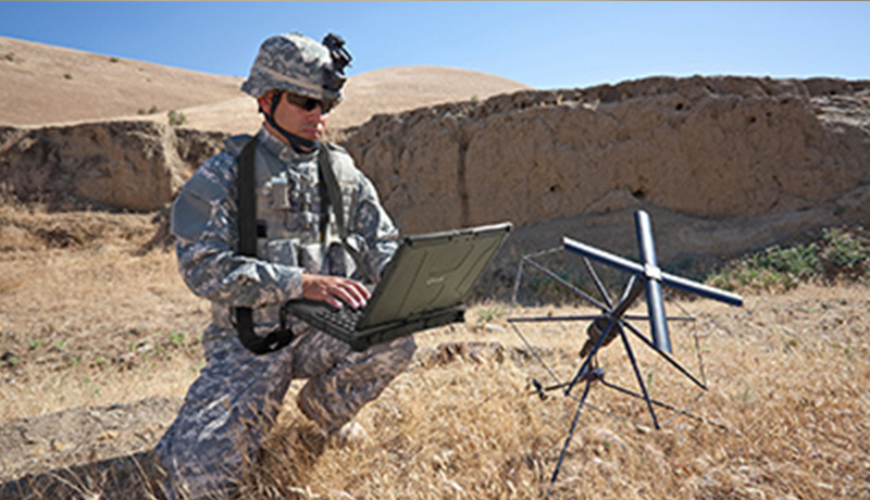
Coordinating GIS surveying equipment in forests and woodlands across the country or the world can be a daunting task, but Getac solutions are here to help. Getac solutions integrate smoothly with the latest GIS mapping and surveying software solutions allowing management to make the most informed decisions using up-to-date information gathered from the field. Robust systems, including Intel® Core™ vPro™ processors and Android OS, enable quick transmission of information to those who need it most.

Access and update natural resource management data easily
For the crew working in the field, accessing and updating data is made easy with Getac solutions. Powerful and fast WiFi and Bluetooth ready your team to pull up the latest geographic and tabular data, whether they are in the office or the woods. That connection also promotes a smooth evaluation, analysis, and recording of tree species, diversity, age, size, density, volume, etc. Enter information with Getac solutions touchscreens ranging in size from a 7” to an 11.6” display and bolster your forest management plans, update forest inventory, and assess insect and disease threats.

GIS for forestry applications using GPS
Direct your team to a specific plot or forest block using Getac solutions optional dedicated GPS, even without connectivity. Search capacity, faster location positioning, and improved accuracy are just a few of the features on the dedicated GPS. Natural resource management down to the tree with GPS reference, determine which forest blocks have been recently surveyed and schedule which areas will be surveyed next, with precision.

Battery life for as long as you need
When you are in the field swinging traditional plots and calculating the merchantable height of your trees, there isn’t time to run out of battery. Getac solutions offer dual batteries with hot-swapping capabilities, meaning you don’t have to log out of your GIS software applications or turn off your device when you change your battery. Bridge batteries or multi-device charging stations are also options for extending your Getac solutions’ battery life.

A solution that works when you do
Nature can be unpredictable, but luckily, Getac solutions work in extreme conditions. Whether you have a Getac tablet mounted in the front seat of your vehicle or strapped to you in the middle of a woodland, our devices are built rugged to handle even your toughest day using GIS surveying equipment. Independently certified up to MIL-STD-810H, IP67, and MIL-STD-461G standards, our laptops, and tablets are vibration, dust, moisture, and drop resistant. Even in extreme temperatures, Getac solutions thrive, rated for operation between -29°C to 63°C.
Our revolutionary touchscreen technology, LumiBond® 2.0, created by bonding glass with a touch panel and LCD to form a single pane, allows for users to touch the screen with fingers, gloves, a pen, a stylus, or even in the rain. An optional digitiser mode captures notes or other writing on maps or forms a perfect addition for your GIS application in natural resources. With up to 1000 NITS of brightness, our screens can be read even in direct sunlight.
VIEW THE NATURAL RESOURCE / ENERGY BROCHURE
Please click on an industry below to learn more


Providing the best quality and service to our loyal partners and clients.
.jpg)
.jpg)
.jpg)
.jpg)
.jpg)
.jpg)
.jpg)
.jpg)